
Trace a Linton Hall Street by Address
A useful street-by-street search is a parcel workflow, not a roster of people. Confirm the road spelling and the physical address first, then use the assessment record to identify the parcel and assessed owner. The GPIN, the county's parcel identifier, links that result to County Mapper and gives the deed search a stronger starting point than a street name alone. A deed chain can then explain an ownership transfer, while a plat can resolve a lot or road alignment. Historical reverse directories are a separate, dated source for a surviving volume. Virginia's voter tools do not provide a public street roster, so they are a legal limit to observe rather than a shortcut around the other records.
- Verify the official road name, number, and type in the county street directory or County Mapper. Save the physical address exactly as it appears.
- Run the address in Prince William County Public Access. Record the situs address, assessed owner, mailing address, GPIN, legal description, and sale details separately.
- Open the parcel in County Mapper to check the street segment, parcel geometry, nearby parcels, and active layers.
- Use the current owner as grantee in the Circuit Clerk land-record index, then search the prior owner as grantor or grantee. Follow the legal description and plat when a deed omits the street address.
- For an older street presence, ask RELIC for the appropriate reverse or criss-cross directory volume. Treat any match as a dated subscriber or occupant clue, not a current household claim.
That sequence keeps the Linton Hall street directory tied to dated county records. It also avoids confusing a tax mailing address with proof that someone occupies the property.
Search Linton Hall Streets in the Assessor
Prince William Tax Administration provides the address-to-parcel starting point for a Linton Hall street directory search. The Address Search form accepts a low house number, an optional high house number, and a street name. The low and high fields are helpful when checking a short range on a road instead of one number at a time. The street-name field is the practical key, so enter it without the directional or suffix where the live form instructs. Once a record opens, it is an annual assessment record, not a declaration of present occupancy.
| Assessor search field | Use on a Linton Hall street | Format note |
|---|---|---|
| House Number | Starts a single-address or range search | Optional low number |
| House Number High | Extends a road-range search | Optional high number |
| Street Name | Locates the road in address search | Effective search key |
| GPIN or Account # | Finds the same parcel after an address search | One alternate search key |
| Sales filters | Narrows sale records by price, date, size, use, style, or neighborhood | Optional fields on Sales Search |
The official assessor Address Search is shown below. Use it to resolve a property record before moving to land records, rather than treating a single displayed name as a list of everyone at the address.
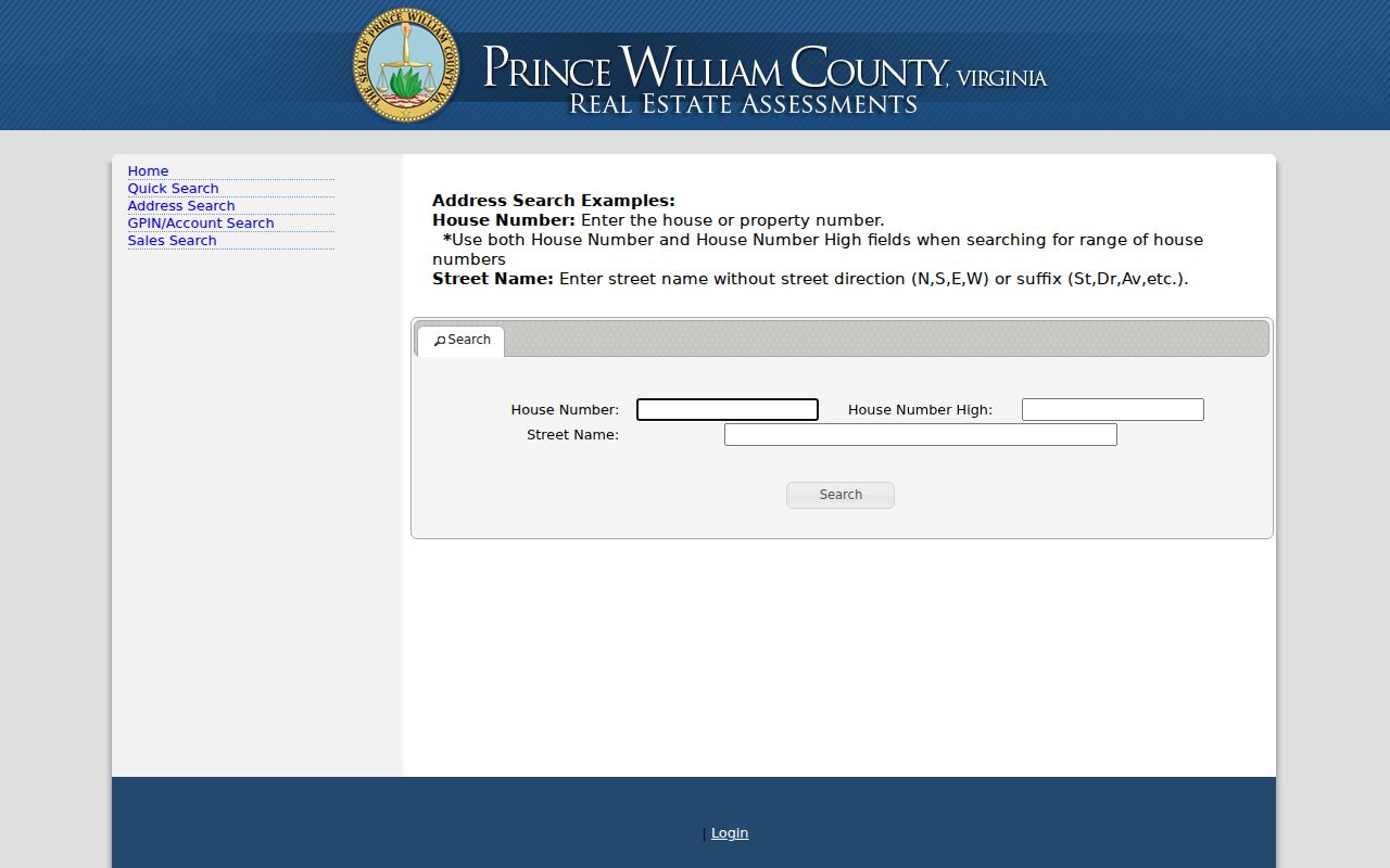
The form's number-range and street-name controls support careful street work. A result still needs its GPIN and legal description carried into the next county system.
Read Linton Hall Street GPIN Records
A GPIN is Prince William County's ten-digit coordinate-grid parcel number, commonly displayed as xxxx-xx-xxxx. It is the most dependable bridge when a road has a similar name, a changed address, or a different postal label. The parcel card also separates facts that should not be blended: the assessed owner and mailing address identify the tax record, while the situs address identifies the physical parcel. The card can show the legal description, land and building details, assessment context, and sale price or date history when available.
- Parcel
- A defined piece of land in the county's assessment and mapping systems.
- Situs address
- The physical address attached to the parcel, used to connect GIS, permits, and property records.
- Plat
- A recorded map that can show lots, blocks, easements, road alignment, and subdivision boundaries.
- Criss-cross directory
- A historical directory organized by address or street instead of only by surname.
The GPIN and Account Search page provides the alternate identifier route. Preserve the GPIN with the address in research notes so that a later mapper, deed, or plat search can be repeated.
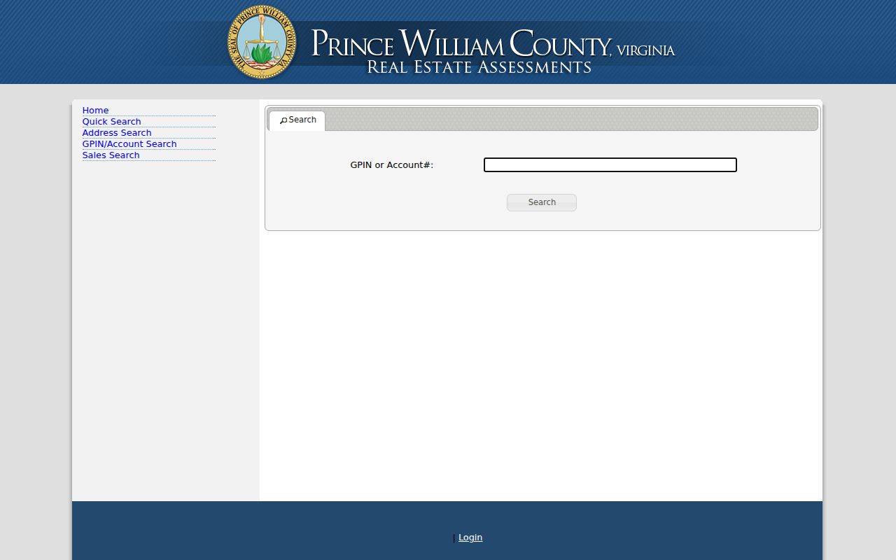
The stable identifier is useful because the same road can carry old labels or postal designations while the parcel record and legal description remain the better county link.
Map Linton Hall Streets in County Mapper
County Mapper adds location and context to a street directory result. Its address tools accept street number, street name, street type, and unit, while the GPIN field can call up a known parcel. The viewer also offers layers for land records, development, public services, utilities, environment, and aerial imagery. Use Identify to examine a point, rectangle, or line and review the Results panel rather than relying on a label drawn on the map. Parcel boundaries and imagery can differ, and the county describes the viewer as informational rather than a survey.
Results can be highlighted, zoomed, cleared, or expanded with More Info. For an address chain, that makes it possible to compare a street segment with district, precinct, and parcel information before opening an individual card. The same Results menu includes List Adjoiners, which is more appropriate for a small parcel cluster than for reconstructing an entire road. Note: Record the active layers and access date because scale-dependent GIS layers and parcel cards can change.
Linton Hall Street Directory Record Coverage
Several county systems use an address, parcel, or legal description, but each answers a different question. The Linton Hall street directory works best when the record type is named beside the result. Assessment data identifies a taxed parcel and assessed owner. A recorded deed establishes a document trail. A permit or public code record can supply a project or case context, but neither creates a reliable list of everyone connected to an address.
| Address-keyed record | County keeper | What it can establish | Access channel |
|---|---|---|---|
| Assessment card | Tax Administration | Assessed owner, mailing address, situs, GPIN, legal description, sales | Public Access portal, phone, or office |
| GIS parcel | GTS/GIS | Parcel geometry, layers, districts, adjacent parcels, aerial context | County Mapper and GTS |
| Deed or mortgage | Circuit Court Clerk | Parties, instrument reference, recording date, legal description | Free index, paid images, clerk counter, or microfilm |
| Plat or subdivision record | Circuit Court Clerk/GIS | Lot, block, easement, road, or replat relationship | Plat index and office fallback |
| Permit or code record | Development Services or PWC 311 | Project, status, inspection, hearing, or service context | ePortal, 311, or Virginia FOIA for an existing record |
The county did not locate a public ZIP-wide owner export or a universal street list. Use one parcel row per record trail, then retain the source URL and date with that row.
Development Services ePortal supplies a basic public search for permits, plans, inspections, hearings, and code cases by address. An account is used for applications and user cases; ask PWC 311 or make a Virginia FOIA request for an existing record when the needed item is not publicly displayed.
Follow a Linton Hall Road Deed Chain
Land records turn an assessor result into an ownership history. In the Circuit Clerk index, search the current assessed owner as a grantee, read the most recent instrument, then search the prior owner in the role stated by the earlier transfer. Names may change through estates, trustees, spouses, entities, or recorded name changes. When the deed does not include a usable street address, carry the legal description, plat reference, instrument number, or book and page back to the index.
Online deed index and image coverage begins in 1918. The plat index begins in 1794, while plat images begin in 1918. For a missing older image, use the clerk's Records Research & Copies Center, historic microfilm, or ask about the Historical Online Portal. Those are distinct access paths, not gaps to fill by guessing from an assessment card.
The county Sales Search can help isolate a sale event before the land-record review. It filters by sale price, dates, size, acreage, use, style, and neighborhood, but the recorded instrument remains the source for the transfer itself.
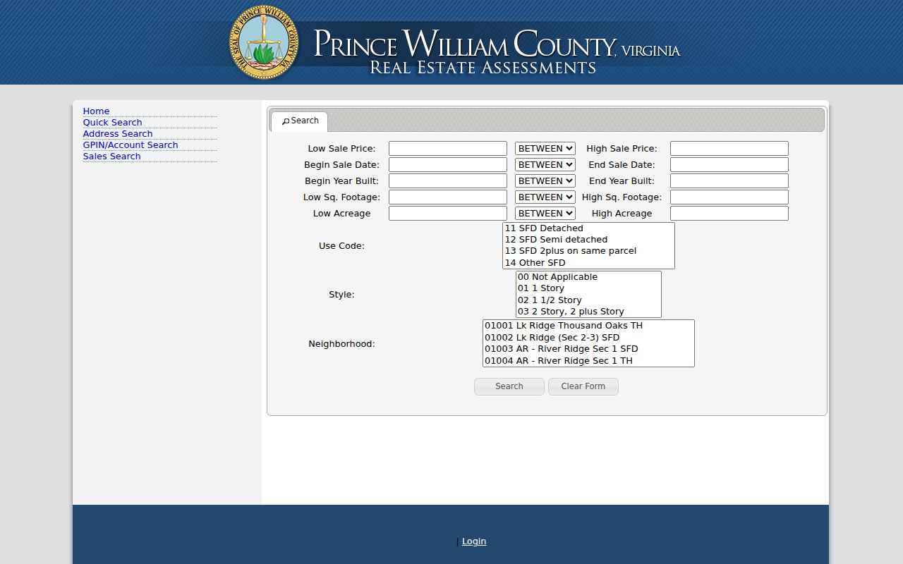
A sales result is a useful cross-check for a date or parcel. Use the Circuit Clerk's online records access route for the deed-index portion of the chain.
The Clerk's free Property Alert system can watch a name or GPIN for a new recorded document. At launch, its Find a Document feature covered only the prior three months, so an older transfer still requires the index, record reference, or clerk research path.
Linton Hall Road's Split ZIP Ranges
Insider tip: Do not treat a road name as a ZIP filter. County street-directory editions place different Linton Hall Road ranges in 20136 and 20155, including a split around the 7974 to 8300 ranges. The postal city can therefore differ along the same road even when the county road name has not changed. Check the printed range, then verify a delivery address with USPS and confirm the parcel by GPIN.
GTS assigns and maintains official addresses, road names, realignments, and readdressing outside the independent cities. Its documents include the county street directory, election-district street directory, address-validation application, and subdivision directory. When an old address misses, search both labels and bridge the result with a plat, road segment, legal description, or neighboring parcel rather than expanding a name search without limits.
Use Linton Hall Plats for Streets
Address continuity can break when a long road is realigned, a number is changed, or a subdivision is built from a larger tract. A current number may identify a later lot even though an earlier deed uses a farm name or metes-and-bounds description. A plat can reveal the lot and block, an easement, or the road alignment that ties those descriptions together. County GTS maintains historical address changes for 2005 through 2015 and notices for 2016 through 2025.
Use the GIS documents and forms page for the official street and addressing materials. If a field is wrong, ask the office that owns it: Tax Administration for an assessment field, GTS for official addressing, the Circuit Clerk for a recorded instrument or index issue, and Development Services for a permit case. Virginia FOIA can request an existing county record, but it does not require a new street report or replace an agency correction process.
Read Historical Linton Hall Street Listings
RELIC is the county's local-history and genealogy center, with directories, telephone books, maps, newspapers, microfilm, and research support. Its reverse or criss-cross volumes can connect a street and house number to a historical subscriber or household reference when the right volume survives. They are snapshots, not continuous occupancy records. A missing entry can reflect the broader Manassas-area geography, a postal label, a subscriber choice, or a collection gap.
Ask RELIC for the correct volume, abbreviation key, and any in-library access rules. For older land material, the Linton Hall and Broad Run area may appear under Prince William, Bristow, Gainesville, Manassas, a rural route, or a farm and place name. The Historic Prince William collection adds a 1972 county street map and local-place material that can help interpret those older labels.
Note: Label a historical directory result by its volume year and source rather than presenting it as a statement about who is currently at the address.
Limits of the Linton Hall Street Directory
Address records do not reveal every person associated with a property. A parcel card can identify an assessed owner and a mailing address, but the mailing address may be elsewhere and is not proof of present occupancy. The public systems also do not provide utility customer records, delivery information, DMV addresses, confidential vital relationships, or a public name-and-street voter roster. The Virginia Citizen Portal is an individual self-status service, and voter-file distribution is restricted by Virginia Code sections 24.2-405 through 24.2-407.
Lawful personal use. Use the minimum public record needed for a property, family-history, or civic question. Public availability does not permit stalking, harassment, intimidation, or publishing a restricted list.
Virginia's Address Confidentiality Program can protect the actual address of eligible participants, and record-specific laws can limit disclosure or require a custodian to withhold information. For an existing county record outside a portal, use the county's Virginia FOIA process and honor the response or denial.